
Skamper
5.8km

Kendal figure of 8 town run — 5.8 km Running Route

Kendal figure of 8 town run is a 5.8 km (3.6 miles) loop in Kendal, Westmorland and Furness: flat, with 35 m of climb, on paved ground.

35 mAscent
Paved100%Paved
1/5Hilly

Start anywhere route. Jump on the course line at any point — wherever you start will also be your finish point.

Kendal figure of 8 town run running route
Loading map…

Photos

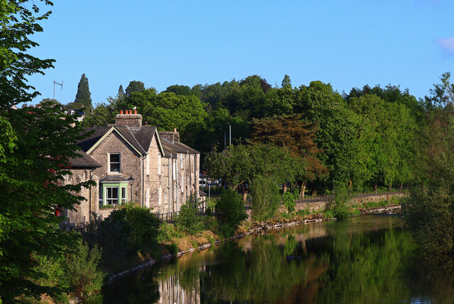
Kendal figure of 8 town run - Photo 1

Elevation

Explore the Kendal figure of 8 town run

Location: Kendal, Westmorland and Furness

A figure-of-eight road circuit through Kendal, covering roughly 6 km entirely on pavement and roads. With around 60 metres of gentle climbing spread across town, it offers an undulating urban run that loops between the river corridor and surrounding neighbourhoods.

The circuit weaves along both sides of the River Kent, running close to open green spaces at Goose Holme and Abbot Hall before cutting along Highgate. Further stretches loop through residential streets towards Mintsfeet and trace the lower streets below Castle Hill, giving a varied cross-section of the town.

Underfoot, it stays on solid pavement and tarmac throughout, providing reliable footing without technical distractions. A straightforward town circuit balancing quiet riverside stretches with everyday streets.

Common questions

How long is this route?
It's a 5.8 km loop in Kendal, Westmorland and Furness with around 35 metres of total ascent.
How long will it take me to run it?
Use the 'Your time estimate' panel at the top of this page — it predicts your finish time for this exact route from your age, sex and most recent benchmark, accounting for distance, ascent and surface.
Is it hilly?
Barely. It rates 1 out of 5 on our hill scale — gently undulating. About 6 metres of climb per kilometre, 35 metres in total.
What's the surface like?
It's 100% paved — runnable in road shoes year-round.

Reviews (1)

MattNov 2026

Can be busy depending on the time of day.

Shoe suggestion: Road

Sign in to write a review.

Keep this run brilliant — report an issue

Every Skamper route is community-monitored. If the path is unclear, blocked, dangerous, or the GPX doesn't match reality — tell us and we'll check it.

Runs on this route

Each runner appears once, with their fastest time — however they recorded it (app, Strava or Garmin).

Loading leaderboard…

Nearby Runs

Explore more runs