
Skamper
14.1km

Hollins, Chrome & Parkhouse Hills, and High Wheeldon — 14.1 km Running Route

Hollins, Chrome & Parkhouse Hills, and High Wheeldon is a 14.1 km (8.7 miles) loop in Hartington Middle Quarter CP, Derbyshire: flat, with 654 m of climb, on mostly trail ground.

654 mAscent
Paved36%Paved
0/5Hilly

Start anywhere route. Jump on the course line at any point — wherever you start will also be your finish point.

Hollins, Chrome & Parkhouse Hills, and High Wheeldon running route
Loading map…

Photos

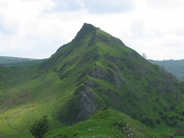
Hollins, Chrome & Parkhouse Hills, and High Wheeldon - Photo 1
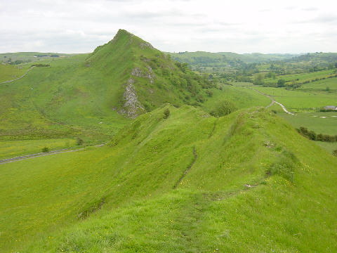
Hollins, Chrome & Parkhouse Hills, and High Wheeldon - Photo 2
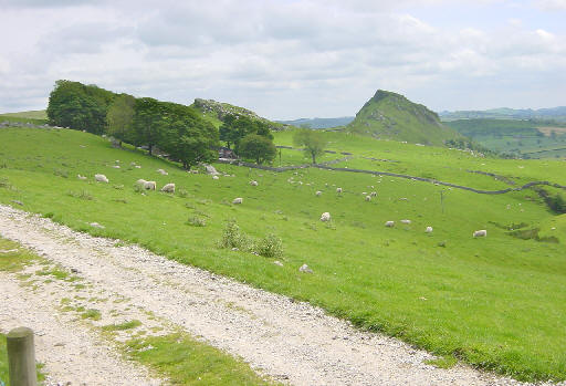
Hollins, Chrome & Parkhouse Hills, and High Wheeldon - Photo 3
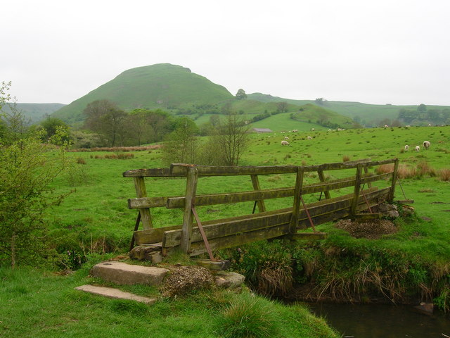
Hollins, Chrome & Parkhouse Hills, and High Wheeldon - Photo 4

Elevation

Explore the Hollins, Chrome & Parkhouse Hills, and High Wheeldon

Location: Hartington Middle Quarter CP, Derbyshire

Starting from the small village of Crowdecote, head west down the valley heading towards the iconic Chrome Hill, passing all the peaks of the route on your right. Visit the honesty box before Hollinsclough before beginning the ascent out of the village to the first Ethel of the route, Hollins Hill. From here you'll have excellent views of Chrome Hill, the next major checkpoint and second Ethel. Descend Hollins Hill and traverse the fields before ascending the unique reef-like Chrome Hill - the beginning of the Dragon's Back.

A rough footpath winds across the ridgeline, or you can tackle the ridge directly. Eventually you'll reach the summit and start the steep descent down to the valley between Chrome and Parkhouse Hills. From there it's a steep ascent up Parkhouse Hill (careful, the limestone can be slippery when wet) followed by yet another steep descent.

The last section of the route is a climb to the village of Earl Sterndale, where you'll head up the road towards the final peak and Ethel, High Wheeldon. It's a final steep ascent to the trig point - make sure you make the most of the view back everywhere you've been! - before descending down to the Pack Horse Inn at Crowdecote for a well deserved refreshment!

Common questions

How long is this route?
It's a 14.1 km loop in Hartington Middle Quarter CP, Derbyshire with around 654 metres of total ascent.
How long will it take me to run it?
Use the 'Your time estimate' panel at the top of this page — it predicts your finish time for this exact route from your age, sex and most recent benchmark, accounting for distance, ascent and surface.
Is it hilly?
No. It rates 0 out of 5 on our hill scale — essentially flat. About 46 metres of climb per kilometre, 654 metres in total.
What's the surface like?
It's mostly off-road (around 64% trail). Trail shoes are recommended.

Reviews (0)

Be the first to review this route

Sign in to share your thoughts about Hollins, Chrome & Parkhouse Hills, and High Wheeldon.

Sign in to write a review.

Keep this run brilliant — report an issue

Every Skamper route is community-monitored. If the path is unclear, blocked, dangerous, or the GPX doesn't match reality — tell us and we'll check it.

Runs on this route

Each runner appears once, with their fastest time — however they recorded it (app, Strava or Garmin).

Loading leaderboard…

Nearby Runs

Explore more runs