


12.1
km
12k Run Grasmere: Scenic Ascent of Stone Arthur and Heron Pike
2:18:30
Estimate
685.3 m
Ascent
20%
Paved
5/5
Hilly
CPs
Elevation
0.0 km
3.1 km
6.2 km
9.3 km
12.3 km
101 m
1 m
Route Overview & Local Insights
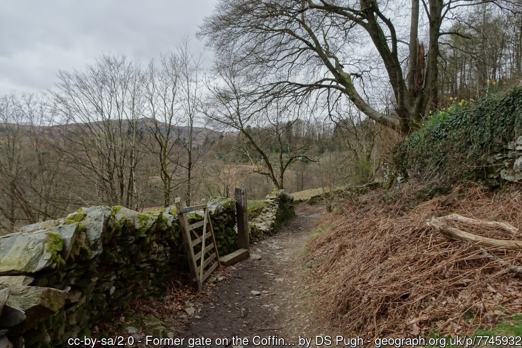
This 12.3km circuit out of Grasmere is a quintessential Lake District fell running experience, packing a punchy 685m of vertical gain. The adventure kicks off with a lung-busting, steep ascent toward the rocky outcrop of Stone Arthur, demanding strong quad engagement and steady pacing. Once you gain the ridge near Great Rigg, the hard work pays off with a sublime, undulating skyline traverse toward Heron Pike and Nab Scar. The terrain is classic Lakeland fell: a mix of technical singletrack, grass, and rocky steps, followed by a knee-testing descent into Rydal. The final leg offers a welcome change of pace as you transition onto the historic Coffin Route, a beautifully maintained trail that contours the hillside back to Grasmere, allowing for a faster, rhythmic finish amid stunning valley views.
Steeped in Romantic history, this route passes through the heart of "Wordsworth Country." The Coffin Route you’ll traverse on the return was historically used to carry the deceased from Ambleside to the consecrated ground at St Oswald’s Church in Grasmere. As you run, you’ll overlook Rydal Mount and Dove Cottage, former homes of poet William Wordsworth, who drew inspiration from these very fells. The high ridge line offers some of the best vantage points in the Lake District National Park, providing panoramic vistas of Grasmere Lake, Rydal Water, and the distant silhouettes of the Coniston Fells. It’s a route that perfectly balances the rugged, untamed nature of the high summits with the deep literary heritage of the Cumbrian valleys.
Plan Your Run
Pace Calculator
Adjust your splits for the 685m of climbing on this 12.3km loop.
10k Training Plan
Build the mountain strength needed to tackle this tough Lake District circuit.
Injury Prevention
Descending Heron Pike is technical; keep your ankles and knees trail-ready.
Nutrition Tools
Fuel properly for a high-intensity 12.3km effort in the fells.
This course has sections close to or above 500m. Weather conditions can change at short notice, so plan accordingly.
This course includes one or more areas where higher levels of caution are recommended and your time is temporarily paused. We suggest reviewing the map in close up, where these sections are shown with dashed lines.
This course includes 0.2 km sections of dashed lines. The total distance for the course including these sections is 12.3 km
13K
Lake District
England
Scenic
Nature
Wildlife
Historic
We use Cookies
This website uses cookies to ensure you get the best experience on our website.