


7.3
km
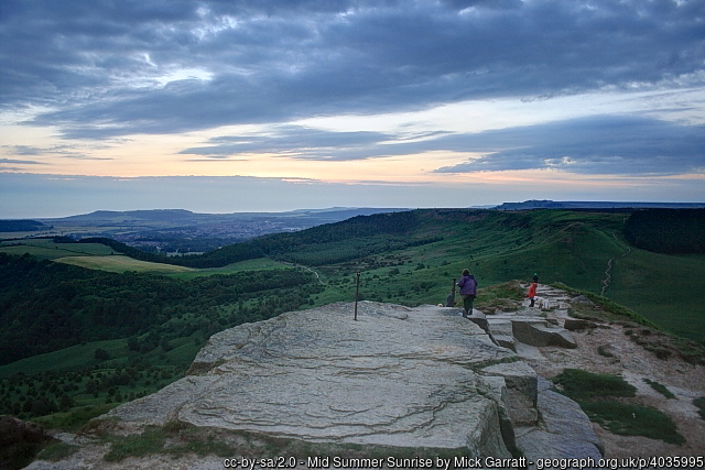
Roseberry Topping from Great Ayton
1:04:28
Estimate
217.5 m
Ascent
25%
Paved
4/5
Hilly
CPs
Elevation
0.0 km
1.8 km
3.7 km
5.5 km
7.4 km
101 m
1 m
Route Overview & Local Insights
This 7.4km loop from the charming village of Great Ayton offers a classic North Yorkshire trail running experience, blending fast-paced village lanes with a lung-busting climb. Starting with a mix of paved surfaces and soft forest tracks, you’ll head into the ancient canopy of Newton Wood before tackling the iconic "Matterhorn of Yorkshire." The ascent up Roseberry Topping is steep and includes a technical set of stone steps that will test your climbing legs, but the 218m of vertical gain is well worth it for the 360-degree views over the Tees Valley and the North York Moors. The descent through Aireyholme Farm provides a rhythmic transition into undulating field paths, making this a perfect short-distance SL (Small-Medium/Long-Short) category trail for runners looking to build their climbing confidence.
Runners will appreciate the deep history embedded in these trails; Great Ayton was the childhood home of the famous explorer Captain James Cook, and you’ll be running through the very landscape that inspired his sense of adventure. The route passes near the site of his family's former cottage and skirts the base of the monument dedicated to him on nearby Easby Moor. Roseberry Topping itself is a geological marvel, shaped by a 1912 geological fault and centuries of alum and ironstone mining. Keep an eye out for bluebells in the spring within Newton Wood, and after your run, follow the local tradition of grabbing an ice cream or a pint of local ale in the village green to cap off a quintessential Yorkshire outing.
Plan Your Run
Pace Calculator
Estimate your finish time for this 7.4km hilly trail loop.
5k Training Plan
Use this scenic climb to build the strength needed for a faster 5k.
Injury Prevention
Tips for handling steep descents and technical forest steps safely.
Nutrition Tools
Fuel right for high-intensity efforts like the Roseberry ascent.
This course includes one or more areas where higher levels of caution are recommended and your time is temporarily paused. We suggest reviewing the map in close up, where these sections are shown with dashed lines.
This course includes 0.0 km sections of dashed lines. The total distance for the course including these sections is 7.4 km
We use Cookies
This website uses cookies to ensure you get the best experience on our website.