


10.5
km
11k Run High Peak: Scenic Adventure from Edale to Mam Tor
1:38:29
Estimate
338.9 m
Ascent
25%
Paved
4/5
Hilly
CPs
Elevation
0.0 km
2.7 km
5.3 km
8.0 km
10.7 km
101 m
1 m
Explore the Around Edale, Rushop Edge and Mam Tor Run
Location: High Peak, Peak District, England
Overview
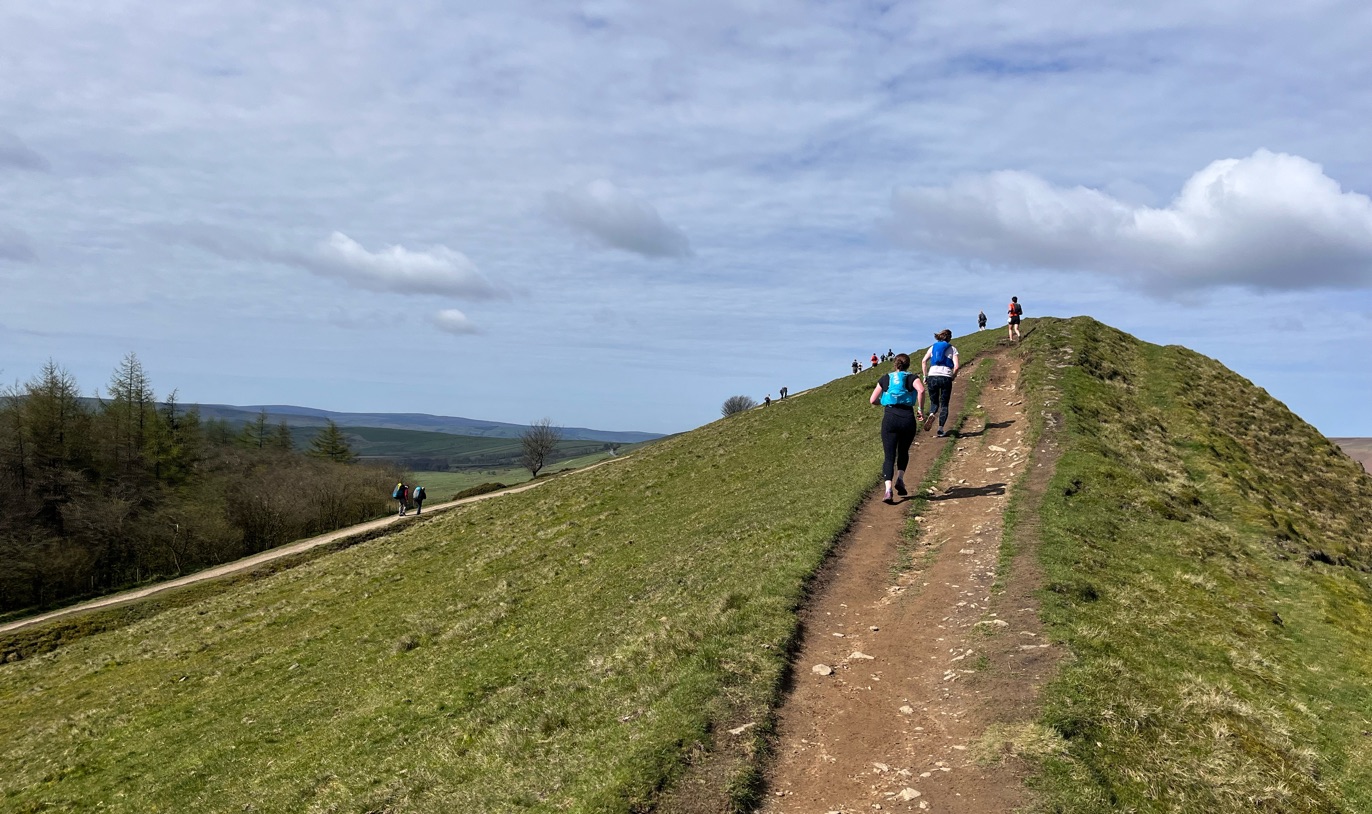
The Around Edale, Rushop Edge and Mam Tor Run presents an exhilarating opportunity for runners to experience the unparalleled beauty of the Peak District. Starting in the picturesque village of Edale, this route promises stunning natural landscapes and diverse terrains. The initial climb through scenic fields leads to Rushop Edge, where you will reach a height of 550m, rewarding your efforts with breathtaking views of rolling moorland and surrounding valleys. This path includes rocky tracks and grassy slopes, inviting runners to challenge themselves.
Continuing toward Mam Tor, famously known as the 'Shivering Mountain', this uphill segment merges spectacular vistas with a rich geological history. The ascent tests your stamina, especially at Hollins Cross, where the descent offers a brief chance to recover before you embark on the final stretch back to Edale. With elevations ranging from 240m to 550m, each uphill and downhill section enhances the thrill of this memorable route. Keep an eye out for local wildlife, including sheep and various bird species, enriching your running adventure through this iconic landscape.
Local Insights
Edale, frequently cited as the starting point of the Pennine Way, boasts a rich history and beautiful surroundings that attract outdoor enthusiasts year after year. During your run, you'll encounter significant landmarks, including the ancient burial mounds on Mam Tor and expansive views that showcase the area's natural splendour. The landscape, featuring rich moors and rugged rock formations,’s ideal for immersing yourself in nature’s beauty while exercising. History runs deep in this region, with roots in mining and agriculture, making it a fascinating area for both runners and walkers.
Health and Fitness Benefits
Engaging in the Around Edale, Rushop Edge and Mam Tor Run provides exceptional cardiovascular benefits while enhancing endurance and providing a full-body workout. Navigating the varied terrains and elevation changes strengthens muscles and joints, contributing positively to overall fitness. Additionally, running in fresh air surrounded by natural landscapes significantly boosts mental health, effectively reducing stress and cultivating mindfulness in a peaceful environment.
To assist in your training, consider using the Running Pace Calculator. This handy tool helps you track your pace, ensuring you optimise your training strategy while preparing for this scenic run.
Recommended Training Plan
For those looking to take on this remarkable route, the Half Marathon Training Plan would be an excellent choice. This plan will help improve your stamina and prepare you for the challenges presented by this varied terrain, ensuring you complete the run with confidence and enjoyment.
Injury Prevention Tips
To enhance your recovery and prevent injuries, consider incorporating Foam Rollers for Runners into your routine. Foam rolling can alleviate muscle tightness, reduce soreness, and improve flexibility, essential for tackling the hilly paths of the Peak District. Maintaining good muscle condition will allow you to perform at your best while staying injury-free during your adventure.
Tips for Runners
The optimal time to run this route is during the spring or autumn when weather conditions are generally more stable. Stay well-hydrated and remain alert for changing weather patterns, as the Peak District can have unpredictable conditions. It's wise to carry a fully charged mobile phone for navigation and let someone know your route and expected return time, particularly when exploring more secluded areas.
This course has sections close to or above 500m. Weather conditions can change at short notice, so plan accordingly.
This course includes one or more areas where higher levels of caution are recommended and your time is temporarily paused. We suggest reviewing the map in close up, where these sections are shown with dashed lines.
This course includes 0.1 km sections of dashed lines. The total distance for the course including these sections is 10.7 km
Scenic
Peak District
Historic
England
High Peak
Nature
Wildlife
11K
We use Cookies
This website uses cookies to ensure you get the best experience on our website.