


24.7
km
Neston Station to Bidston Station
3:58:05
Estimate
10.6 m
Ascent
50%
Paved
0/5
Hilly
CPs
Elevation
0.0 km
6.2 km
12.5 km
18.7 km
25.0 km
101 m
1 m
Neston Station to Bidston Station Run
Location: Neston, England
Overview
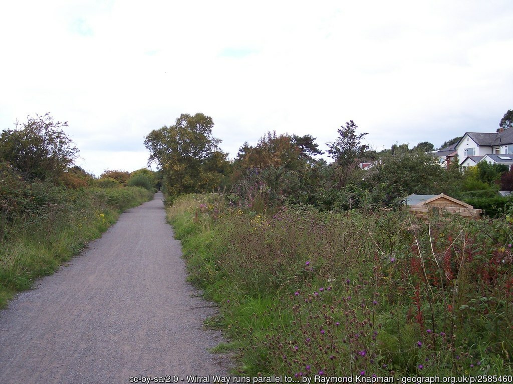
This exhilarating point-to-point route from Neston Station to Bidston Station covers just over 24km along the picturesque Wirral Way, a former railway line that has been transformed into a scenic running trail. Starting your journey at Neston Station, you will immediately find yourself immersed in the beauty of the surrounding countryside. The initial stages of the route are marked by lush fields and the comforting scent of woodlands, which set the tone for an enjoyable run.
The trail is mostly flat, making it accessible for runners of all levels. As you progress, you will experience delightful sections of the path that meander through wooded areas and open fields, each offering unique perspectives of the landscapes. The route also provides glimpses of the stunning Dee Estuary, best appreciated on clear days, where the majesty of nature unfolds before you.
Along the way, there are slight ascents of about 10m, adding a little challenge without overwhelming the runner. The combination of the smooth terrain and gentle hills ensures a steady, continuous pace, ideal for both running and leisurely walking. Take care of occasional road crossings, as they require attentiveness at points along the path.
Your adventure culminates as you approach Bidston Station, where the views deepen in their beauty, and the sense of achievement grows. This route is not only a chance to enjoy nature but also a fantastic way to escape the hustle and bustle of urban life, making it a memorable experience for outdoor enthusiasts.
Local Insights
The Wirral Way is steeped in local history, tracing its lineage along the route of an old railway line that once connected the towns of Neston and Bidston. Surprisingly, the area is home to a variety of wildlife, including birds and small mammals, that often accompany you on your run. The surrounding scenery shifts constantly – from the views of the estuary to serene groves of trees – immersing you in nature's tranquillity. Key landmarks along the route include the remnants of old railway stations, which provide a historical touch to your journey and a perfect spot for a quick rest. Whether you're an avid runner or someone who enjoys a casual jog, this route offers a splendid blend of relaxation and enjoyment.
Health and Fitness Benefits
Running this route offers numerous physical and mental health benefits. The continuous flat terrain promotes enhanced cardiovascular health, while the slight ascents help in endurance building. The calming scenery contributes to stress relief, enabling a serene running experience that clears the mind and uplifts the spirit. Regularly engaging with this trail can lead to improved mental well-being and increased physical fitness, making it a worthwhile pursuit for any fitness enthusiast.
To optimise your training, consider using the Running Pace Calculator. This tool helps you track your pace and adjust your training strategy, ensuring you stay on track for your fitness goals while running the Neston to Bidston route.
Recommended Training Plan
For those looking to tackle this scenic route, consider following the Half Marathon Training Plan. This plan is designed for runners aiming to enhance their endurance and prepare for longer distances, making it ideal for the 24km stretch of the Wirral Way.
Injury Prevention Tips
To help prevent injuries and enhance your recovery, consider using Calf Compression Sleeves. These sleeves can improve circulation and support your muscles during the run, especially over the varied terrain of the route. Incorporating calf compression into your routine will aid in preventing fatigue and enhance your overall performance.
Tips for Runners
For an optimal running experience, consider early morning runs to enjoy the tranquillity of the trails. Stay hydrated, especially during warmer months, and be cautious of the road crossings along the route. Ensure your phone is fully charged and that you have access to data, as the signal can be spotty in the more rural sections. Above all, savour the beautiful surroundings as you conquer this scenic journey.
This course includes one or more areas where higher levels of caution are recommended and your time is temporarily paused. We suggest reviewing the map in close up, where these sections are shown with dashed lines.
This course includes 0.3 km sections of dashed lines. The total distance for the course including these sections is 25.0 km
Run
Countryside
25K
England
Woodland
Scenic
Nature
Wildlife
We use Cookies
This website uses cookies to ensure you get the best experience on our website.